It’s a beautiful start to the day. There’s a bit of cloud cover but the sun is shining. It’s a cool, crisp 62 degrees which means the jacket is coming out again. It’s chilly but should warm up soon. I’m also not expecting any rain today and not covering my bag so stowing my jacket later on won’t be an issue.

The first stop for the day is just 10 miles down the road, the Meteor Crater Museum. It’s not open so I can’t go in but if you’ll notice, there’s a sign with the sun on it. Each planet has it’s own sign and placed the appropriate distance from the sun sign. Not sure what the scale is, but the furthest planet, Neptune, is back by the interstate, almost two miles away. I thought is was a neat way to show some perspective.
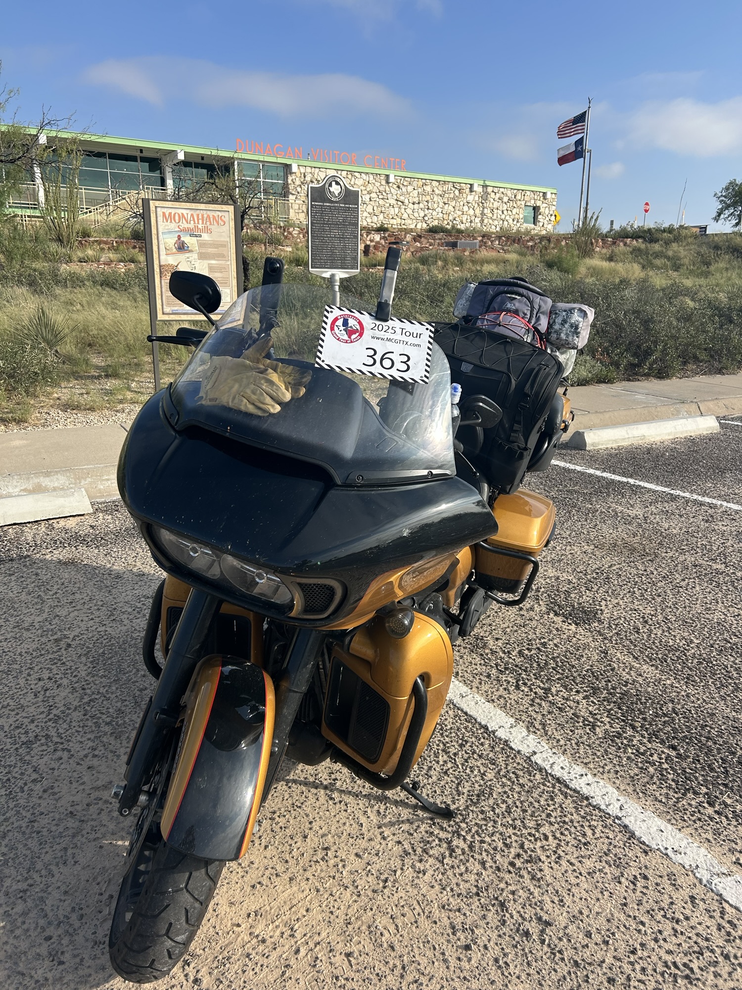
Our next stop is a short 25 mile run down I-20. This stop is the Dunagan Visitor Center, the entrance to Monahans Sandhills State Park. The sand dunes are just a but further down the road and not only can you camp there, you can sled down the dunes. I finish getting my photos and head up to use the restroom. A roadrunner jumps from the brush and leads the way. I see no coyote.
From visitor center it’s a quick run down the interstate access road to Highway 18. This highway has a single curve on it the whole way into the small town of Kermit. Kermit is not named after a frog but rather after Kermit Roosevelt, son of President Theodore Roosevelt.
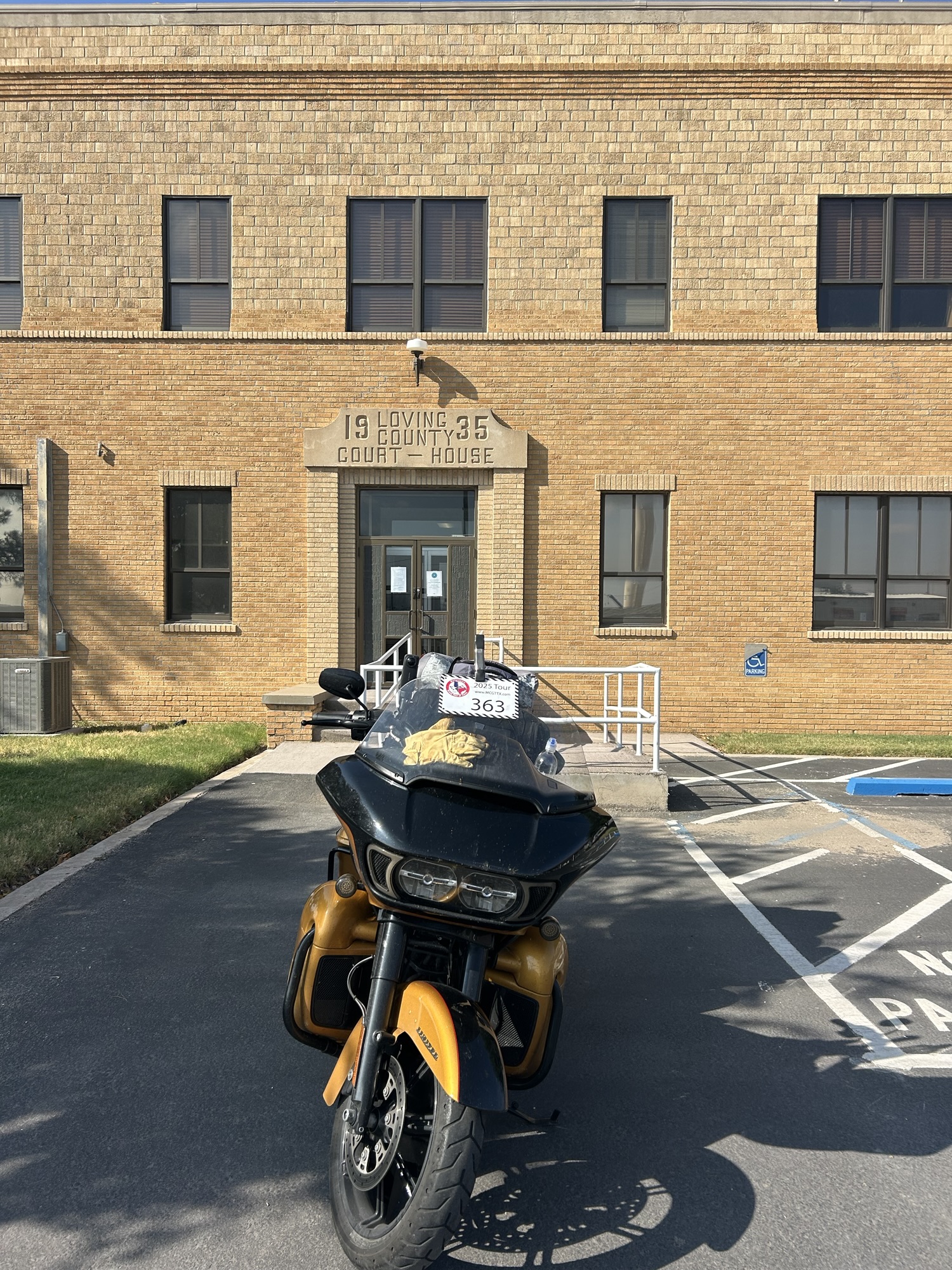
At Kermit we turn onto Highway 302 which has just a few curves in it leading into Mentone. There’s not a lot out on this stretch but what is out here is oil related. The third stop of the day is is the Loving County Courthouse in Mentone. It’s a very plain, square building, nothing fancy or old-style about it. A quick stop to fill up across the street and stow away my jacket. What cloud cover existed before has now cleared and it’s warm enough now that I don’t need it.
It’s just about 150 miles to our last stop for the day. It’s all the same view all the way to Fort Stockton, desert and oil related buildings. As we get close the cloud cover starts to thicken again, but there’s nothing that looks to be dropping rain. At Fort Stockton I stop at an abandoned grocery store, I’ve got to get off the bike for a minute as my backside is getting sore.
The road out of Fort Stockton continues to be straight for a bit before finally getting into some hills. The road now starts to twist around and over the hills. At Marathon I head towards town to fill up. We’re now just a few miles from our next stop which is between Marathon and Sanderson and has no physical address.
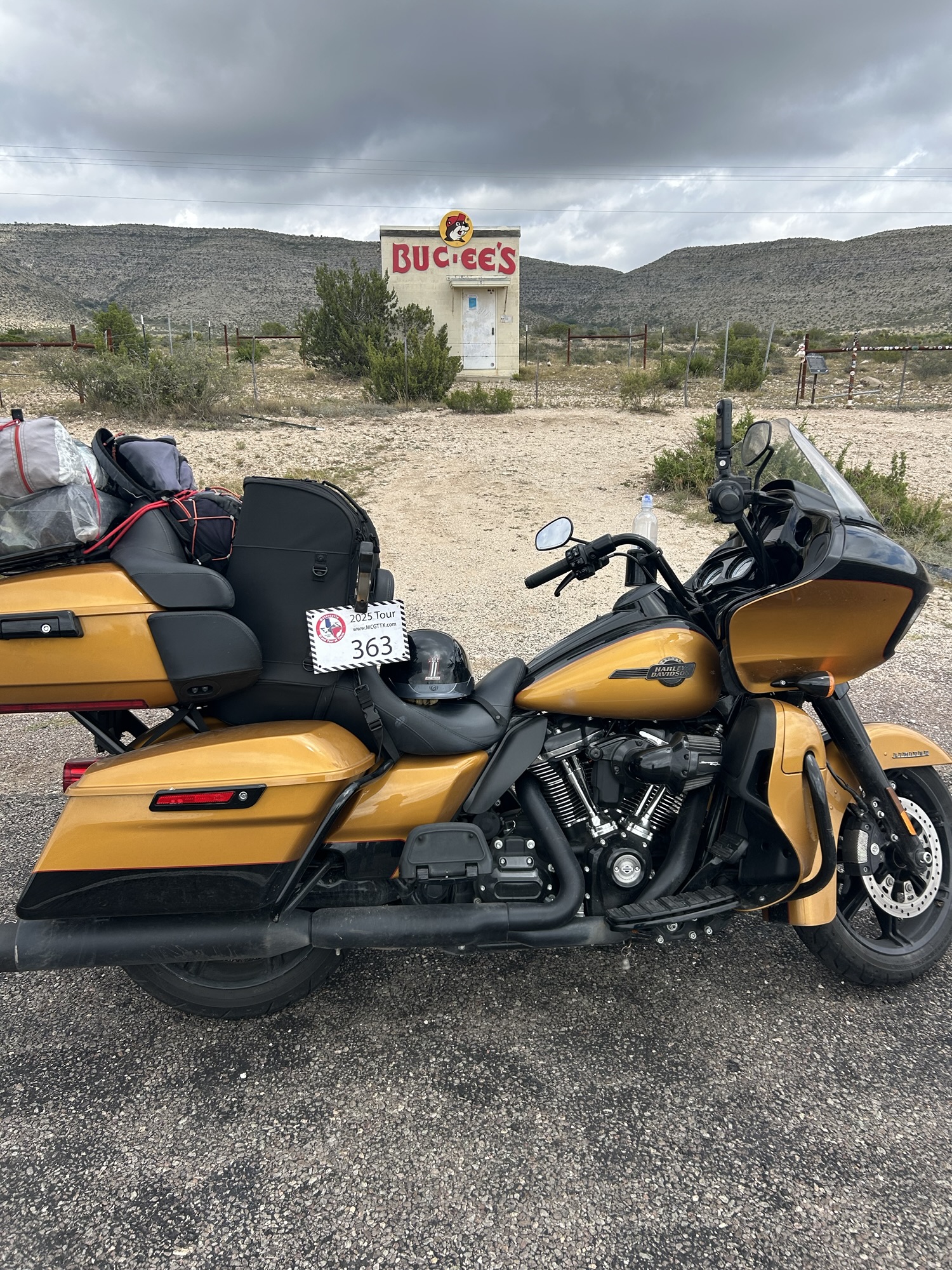
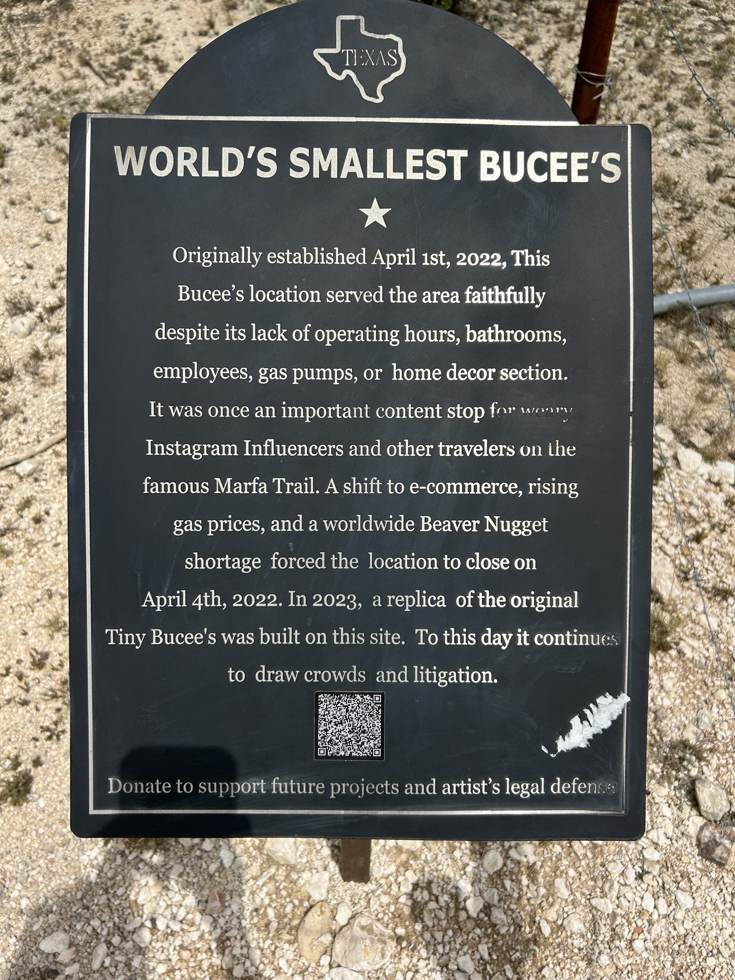
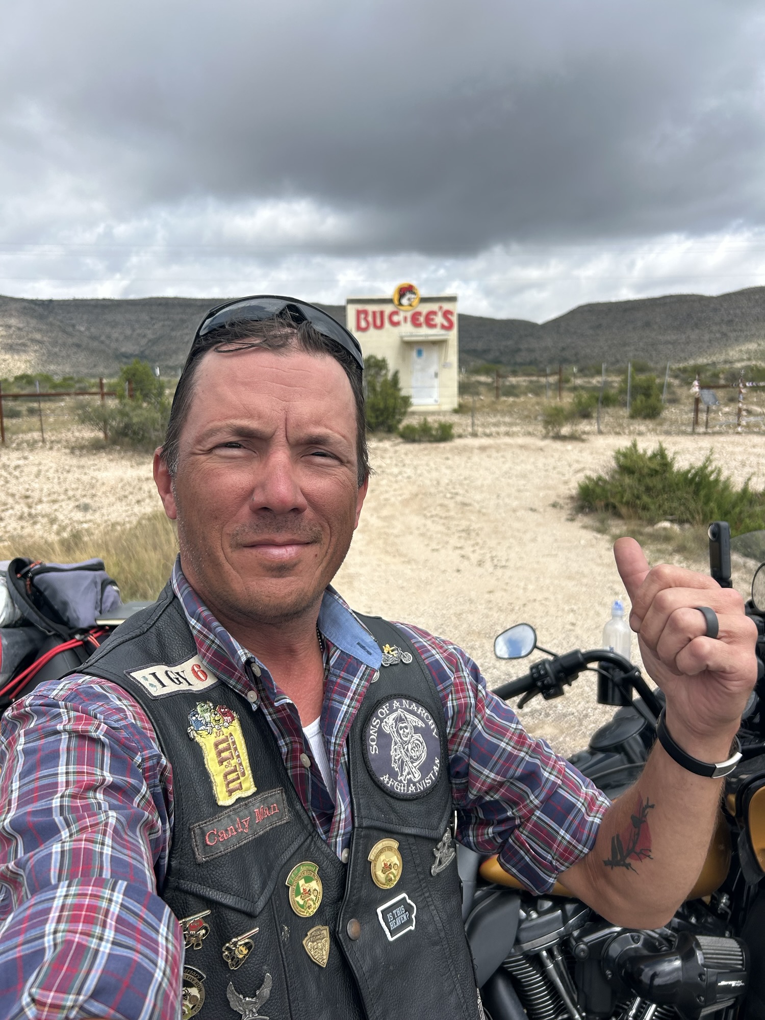
Our final tour stop for the day is just 20 miles down the road which runs between two small mountain ranges. The last tour stop is billed as the World’s Smallest Buc-ee’s. It’s the tour stop I’ve been looking forward to getting to the most. Not the best Buc-ee’s location as they have no gas and are they’re out of Beaver Nuggets.
It’s another 30 miles to Sanderson where I’m hoping to find some lunch. We get a few miles down the road when the sky ahead starts to turn really dark. I pull to the shoulder to check the radar but have no signal. I decide that I am certainly going to run into some weather so I pull out my jacket, which is my rain hear now, and cover my bag. Back on the road I soon come into the weather. Sprinkles at first, then quickly into a hard and heavy downpour. It lasts for just a minute but soaks me all the same.
We catch nothing more than sprinkles the rest of the way into Sanderson. I pull off into a gas station and have a signal again. A quick radar check shows that I may be good the rest of the day. But I’m not going to unwrap my bag to stow my jacket. There’s only one real option for lunch and it’s food truck barbeque, pass. Looks like we’re skipping lunch but I’ve got my GPS directions back so we carry on.
The road is really running through the mountains now, twisting and turning as it climbs and drops. Occasionally cutting into the landscape, creating 50 foot rock walls on either side of the road. The road often shows signs of rainfall but with all it’s twisting and turning I can’t tell if I’m avoiding the dark clouds in the distance or chasing them. Turns out I’m chasing them. Just 50 miles from Del Rio, our final destination for the day, the rain returns. It’s not bad for a while, moderate but not enough to really slow me down except on curves. It soon increases to another heavy downpour that lasts for a good few miles. Visibility becomes an issues as I have no wipers. I’m slowed a bit until the rain finally lets up. Thankfully there’s not much wind. The rain continues all the way into town, stopping only once for a brief few miles.
I’m thinking dinner might be pizza delivery again but the rain finally stops long enough for me to get out. I head for the Blue Oasis. They’ve got a good amount on their menu but I opt for the avocado turkey sandwich, which I inhale. The Blue Oasis is a nice place with some decent patio seating, but the parking lot is an absolute mess of potholes.
I’ve got six stops left and have to do some planning tonight to see if I will make it home tomorrow or the next day. I got in early today since I skipped lunch and would have pushed on further if not for the weather. We’ll see what happens.
